Saturday, 8 October 2011

Pakshippathalam


Pakshipathalam in the Brahmagiri hills at Thirunelli, is a challenging tourist spot for any adventure seeking tourist. To reach Pakshipathalam 17 km have to be covered through wild forest. The deep rock caves, formed among the thick blocks of rocks at the northern top end of Brahmagiri, are the abode of various birds and wild beasts. It is situated at an altitude of 1740m above sea level.
Wayanad, the northern hill district of Kerala, is covered with dense, moist deciduous forests teeming with elephants, tigers, jungle cats, civets, bison, peacocks, wood peckers and numerous other animals and birds. In the sylvan solitude of this land, perched at a 1740 m above sea level is Pakshipathalam, a picturesque sleepy little place.
Pakshipathalam - the very name of the place refers to its large population of birds. 
Here virgin forests, rivulets and steep hills together offer challenging avenues for trekking. A cave which rishis (saints) are believed to have used for meditation in ancient times, has become a major attraction for tourists. This hill station offers great opportunities for bird watching
Close by is Kuruvadweep, an island (dweep) well known for its rare ecology. Located 17 km from Mananthavady, Kuruvadweep is a 950 acre stretch of evergreen forests on the banks of the Kabani River, and home to rare species of birds, orchids and herbs.
Location: Only 7 km northeast of Thirunelli , which is about 32 km from Mananthavady, and about 66 km from Kalpetta, Wayanad district, north Kerala.

Details: One has to obtain special permission from forest department to go to Pakshipathalam. District Tourism Promotion Council arranges vehicle, guides and camping apparatus to the tourists on hire.

Wayanad Wildlife Sanctuary

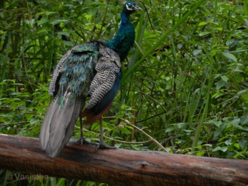
Wayanad Wildlife Sanctuary is an animal sanctuary in Wayanad, Kerala, south India. It is on the way from Mysore to Sultan Battery. Wild animals such as Indian Bison, elephant, deer and tiger has been spotted. There are also quite a few wild birds in the sanctuary.Peacocks and Peafowl tend to be very common in the area.

Wayanad Wildlife Sanctuary is the second largest wildlife sanctuary in Kerala. It is bestowed with lush green forests and rich wildlife. Also known as the Muthanga Wildlife Sanctuary, this wildlife area houses some of the rare and endangered species of both flora and fauna.

Established in 1973, the sanctuary is now an integral part of the Nilgiri Biosphere Reserve. It’s bounded by protected area network of Nagarhole and Bandipur of Karnataka in the northeast, and on the southeast by Mudumalai of Tamil Nadu.

It is part of the Wayanad plateau and the vegetation is predominantly of the south Indian moist deciduous teak forests. Also, the sanctuary has pastures of the west-coast semi-evergreen trees. The wildlife sanctuary comes under Protect Elephant and one can spot herd of elephants roaming in the area.

Elephant rides are arranged by the Forest Department,Kerala. Discovering and observing the wildlife while being atop an elephant is an enthralling and unforgettable experience. Wayanad district has the largest population of aborigine people in Kerala. The native aadivasis mainly consist of various sects like Paniyas, Kuruma s, Adiyar s, Kurichya s, Oorali s, Kattunaikkan s etc. Comprising an area of 2126 km2, Wayanad has a powerful history. Relicts and edicts found in various parts of Wayanad speak of an importatnt prehistoric era. Historians are of the view that organised human life existed in these parts, at least ten centuries before Christ.


The sanctuary is part of the Nilgiri Biosphere Reserve. The Western Ghats, Nilgiri Sub-Cluster (6,000+ km²), including all of the sanctuary, is under consideration by the UNESCO World Heritage Committee for selection as a World Heritage Site.[1]

Wayanad climate is salubrious. Average rain fall in this district is 2322 m.m. Annual rain fall in these high rain fall areas ranges from 3,000 to 4,000m.m. High velocity winds are common during the south west monsoon and dry winds blow in March-April. High altitude regions experience severe cold. This place experiences a high relative humidity which goes even up to 95 per cent during the south west monsoon period. Generally, the year is classified into four seasons, namely, cold weather, hot weather, south west monsoon and north east monsoon. The dale, 'Lakkidi', nestled among the hills of Vythiri taluk has the highest average rainfall in Kerala.


Location: Wayanad Wildlife Sanctuary is located 16 km east of Sulthan Bathery in the state of Kerala.

Edakkal Cave


The name “Edakkal” literally means “a stone in between”, and this describes how the cave is formed by a heavy boulder straddling a fissure in the rock. Inside the cave is on two levels, the lower chamber measures about 18 feet long by 12 feet wide and 10 feet high and can be entered through an opening of 5 x 4 feet. A passage opposite the entrance leads upward to a small aperture in the roof through which one climbs up to the next storey whose interior is about 96 feet long, 22 feet wide, and 18 feet high. Light enters the cave through a big gap at the right-hand corner of the roof where the boulder does not touch the facing wall.
The petroglyphs inside the cave are of at least three distinct types. The oldest may date back to over 8,000 years. Evidences suggest that the Edakkal caves were inhabited several times at different points in history.
The caves were accidentally discovered by Fred Fawcett, a police official of the erstwhile Malabar state in 1890 who immediately recognised their anthropological and historical importance. He subsequently wrote an article about them, attracting the attention of scholars.
The caves contain drawings that range over periods from as early as 5000 BC to 1000 BC. Recently the youngest group of paintings was in the news for a possible connection to the Indus Valley Civilization. Historian M.R. Raghava Varier of the Kerala state archaeology department identified a sign “a man with jar cup” that is the most distinct motif of the Indus valley civilization. The finding made in 2009 September indicates that the Harappan civilization was active in the region. 

Interestingly, the “a man with jar cup” symbol from Edakkal seems to be more similar to the Indus motif than those already known from Tamil Nadu and Karnataka. Mr. Varier said “The discovery of the symbols is akin to that of the Harappan civilisation having predominantly Dravidian culture and testimony to the fact that cultural diffusion could take place. It is wrong to presume that the Indus culture disappeared into thin air.” The scholar of Indus and the Tamil Brahmi scripts, Mr. Iravatham Mahadevan said the findings were very significant called it a "major discovery".

Location: located at Ambukutty Mala 25 km from Kalpetta.

Pazhassiraja Tomb


The tomb of the celebrated historical giant and reputed warrior Veera Pazhassi is a historical monument that has laid his great memories on the sands of time. It is a protected monument under the department. A small site museum is also functioning here.
Kerala Varma Pazhassi Raja belonged to kottayam royal family. He revolted against the British revenue policy by organising the tribals like Kurichiyas and Kurumbas of Wayanad. His strong guerilla warfare could successfully resist the wicked British forces several times. He succeded in winning the full support of his people in this long war with the foreign power. At last due to the ingratitude of some of his fellowmen, the 'Lion of Kerala' had to surrender. But before being captured by the British he is said to have committed suicide on 30th November 1805. The dead body of the great patriot was brought at Mananthavadi in the leadership of T.H.Baber the then sub collector of Malabar and buried there with all respect.

Kuttanad


Kuttanadu is a region in the district of Alappuzha, in the state of Kerala, India, well known for its picturesque vast paddy fields and its geographical peculiarities. It's the region with the lowest altitude in India, and one of the few places in the world where farming is carried out below sea level. It’s also one of the historically important places in the ancient history of South India.
The Kuttanad region is broadly classified into three divisions:
          Lower Kuttanad
          Upper Kuttanad
          North Kuttanad
The major occupation in Kuttanad is farming. Rice is the important agricultural product, giving Kuttanad the moniker of "The Rice Bowl of Kerala". Three crops are grown every year now instead of the traditional two per year. Large farming areas near vembanad Lake were actually reclaimed from the lake. The history of the paddy cultivation in Kuttanad can be traced back to centuries. 

The evolution of paddy cultivation in Kuttanad was correlated to the technological advancement and changes in the regulatory frame work existed during the 19th and 20th centuries. In the earlier times, the reclamation was done mainly from the shallow part of the Vembanad Lake or from the periphery of river Pamba. These reclamations constituted small areas of paddy fields called “Padsekharams”.The bailing out of water from those fields were done manually using water wheels named “Chakram”. Gradually the manual method used for bailing out of water gave way to steam engines.
 
Location: Around 15 km from Alappy.


Wednesday, 15 June 2011

Vallikunnu Beach

          The Vallikunnu beach has always been regarded as a great spot to indulge in a soulful communion with nature. As you sit contemplating on the unspoiled beauty of the place, you will almost be lulled to sleep with the rhythmic clapping of the waves against the sandy beach. Watch the local fishing folk go about their day-to-day activities, chat with them or explore the nearby village - you will surely have an agreeable beach holiday at Vallikunnu. Kadalundy bird sanctuary is situated near this beach. There are several places to stay. 
There is a Guest House in Malappuram under the Department of Tourism. PWD Rest houses and Tourist Bungalows are also available at important centres. There are Rest houses under University of Calicut at Thenhippalam, under K.F.R.I. at Nilambur and under Kerala Water Authority at Tirur. In the private sector, there is a 2 star hotel at Malappuram. Hotel Sabrina, Perintalmanna, KTDC Hotel Sabala, Nilambur, KTDC Hotel Sabala, Perinthalmanna are good to stay.
Location: only 28km away from Calicut.

Peruvannamuzhi Dam

       Peruvannamuzhi or Peruvannamoozhy is a village in Kozhikode district, Kerala, India which is near the PERUVANNAMUZHI DAM over a river. It is known for tourism, wildlife and research on spice crops.
There is a reservoir with facilities for boating, and nature reserves. The reservoir supplies irrigation water to Kozhikode, Malapuram and Kannur.
The  region offers immense scope for picnicking. The reservoir here provides facilities for speedboat and rowboat cruises during which one can see the 'Smaraka Thottam', a garden built in the memory of the freedom fighters of the region.
Uninhabited islands, a bird sanctuary and a crocodile farm add to the charm of the place. Other attractions include a crocodile farm and gardens. Peruvannamuzhi is rich in bird life and over 90 species of birds have been recorded at the Experimental Farm of Indian Institute of Spices Research.
Location: It is located about 60 km North East of the Calicut.
Related Posts Plugin for WordPress, Blogger...