Showing posts with label BeautySpot. Show all posts

Sunday, 9 October 2011

Varkala Beach

Varkala is also famous for 2,000 years Janardana Swami temple is an important sanctuary Vaishnavaite in India and is often referred to as Dakshin Kashi (Benares of the South). The temple is located close to the Papanasam beach, which is considered to have holy waters which wash their sins, and is also an important center for Ayurveda treatment. The temple has an ancient bell removed from a shipwreck, donated by the captain of the Dutch ship which sank near Varkala without causing any casualties.

 Varkala is a tourist destination. The town has excellent telecommunication facilities, an average nominal power system, fire station, several post offices and police station. The city can boast of modern medicine run by the government, ayurveda, hospitals and nature cure, and more than 10 private hospitals, clinics and some dental clinics.

Location: Situated at a distance of 50 Km from Trivandrum. Only 32 Km from Kollam. 

Kollam Beach


 Kollam district, earlier known as Quilon district, is one of the fourteen districts in Kerala, India. The district is representative of all the natural properties in Kerala and has a long coastal region, a major port on the Arabian Sea Astamudi inland lake and was called Tarsish. Kollam is the capital of trade and cashew processing industry in Kerala. Kollam is also known as God's own funds.
           Kollam district has five administrative divisions (taluk): Punalur, Kunnathur, Kottarakkara, Karunagappally and Kollam. District Collector, a key leader of the government, heads of district administration and exercises great power and responsibility. He or she plays a dual role. A security agent for the government and others as chief administrator of the district, under the state government. 
Among other tasks, policing a priority for the District Collector. District Collector is also the head of the Department of land revenue for the district. The District Collector of Kollam now is Devendra Kumar Dhodawat. IAS. The district has a single revenue division with headquarters at Quilon. For administrative reasons, Kollam district is divided into 5 thaluks, 13 blocks, 69 Panchayats, 1 Company 2 communes and 104 villages.

Location: Only 2.5 Km from Kollam. 

Bekal Fort


'Bekal Fort' is the largest fort in Kasargod, Kerala, India, spreading over 40 acres (160,000 m2). Important features of this fort are the water-tank with its flight of steps, the tunnel opening towards the south, the magazine for keeping ammunition and the broad and wide steps leading to the Observation Tower which is a rarity. From there one has ample view of towns in the vicinity like Kanhangad, Pallikare, Bekal, Kottikkulam, Uduma etc. The nearest railway stations are Pallikare, Kotikulam, Kanhangad,and Kasargod.This observation center had strategic significance in discovering even the smallest movements of the enemy and ascertaining safety of the Fort.


The Fort appears to have been built up from the sea since almost three fourth of its exteriors is drenched and the waves continually stroke the citadel. The Mukhyaprana Temple of Hanuman and the ancient Muslim Mosque nearby bear testimony to the age-old religious harmony that prevailed in the area. The zigzag entrance and the trenches around the fort show the defense strategy inherent in the fort.

Unlike most other Indian Forts, Bekal fort was not a center of administration for no remains of any palace, mansion or such buildings are found within the fort. Arguably the fort was built exclusively for fulfilling defense requirements. The holes on the outer walls of the fort are specially designed to defend the fort effectively. The holes at top were meant for aiming at the farthest points; the holes below for striking when the enemy was nearer and the holes underneath facilitated attacking when the enemy was very near to the fort. This is a remarkable evidence of technology in defense strategy.

Tourism promotion activities have been taking place of late in the areas surrounding the fort, under the Bekal Resorts Development Corporation (BRDC), which is an initiative by the Government of Kerala. The song 'Uyire' (Tamil) 'Bombay' directed by Mani Ratnam has been shot at Bekal Fort. Many such films, music albums, commercial advertisements etc., are being shot at Bekal Fort.


Location: Only 8 km from Kanhangad town. And 18 km from Kasargod. Only 60 km from Mangalore International Airport.

Valapattanam


Valapattanam is a small town in the Kannur district, located in the Indian state of Kerala. It is also the smallest panchayath in kerala.Its area is 2.04 sqr Km. Valapattanam is an important Muslim settlement area in Kannur.  Valapattanam is known for its communal harmony. On one hand one can see the "Kalarivathukkal temple" and on the other hand you have the "Kakkulangara Mosque" lying in close proximity. The long vision of the social leaders and people on the whole has made Valapattanam a land of communal harmony.
This town is also known as Balyapattanam. This town is in the on the banks of Valapattanam river. This town is well known for its wood-based industries and timber trade. Centuries back Valapattanam River (puzha) was the main ship route for trading and Valapattanam was the main town, because of this the town got this name. "Valya pattanam" means "big town" in Malayalam language though it is the smallest panchayath in Kerala. The port of Azhikkal is located nearby. In the bank of Valapattanam River you see Western India Plywoods Ltd., the largest wood-based industry in the country and which was the biggest plywood factory in Asia till few years back.
The famous Muthappan temple is in the bank of Valapattanam River.
This town is named after its historical founder Vallabha II of the Mooshika dynasty (Kolathiri family) and was originally known as Vallabha-Pattanam and served as the capital of the Mooshika dynasty during the medieval ages. The fourteenth-century narrative of Ibn Battuta refers to the ruler of Ezhimala as residing at Baliapatanam and offers a clue that by this time, the centre of the political authority had shifted from Ezhimala to Baliapatanam. In the sixteenth century AD, a Portuguese official Duarte Barbosa also mentions Baliapatanam (Baliapatam in European records) as the residence of the ‘king of Cannanore’.
Valapattanam is a strong bastion of the UDF and its ally IUML. It is part the Azhkkodu Legislative assembly constituency where KM Shaji of UDF is likely to win th 2011 assembly elections with a thumping majority.

Location: It is about 7 km north of Kannur.

Ezhimala Hill


Ezhimala , a hill reaching a height of 286 metres, is located in Kannur District of Kerala, South India. As the former capital of the ancient Mushika Kingdom, it is considered to be an important historical site. It is a conspicuous, isolated cluster of hills, forming a promontory 38 km north of Kannur Town. A flourishing seaport and center of trade around the beginning of the Common Era, it was also one of the major battlefields of the Chola-Chera Wars of the 11th century. It is believed by some that Lord Buddha had visited Ezhimala. The hill was once known as Mount Delly by the English or Monte D'Ely by the Portuguese. This region is also known as Elimala, Mooshaka Sailam and Sapta Sailam.
Athulan describes the later kings of this dynasty, who are now better known as the Kolathiri Dynasty. King Ramaghata Mooshika's successors shifted their capital to Pazhi (the present-day village of Pazhayangadi), Valabhapattanam (Valapattanam), and other nearby places over the centuries.
Ezhimala, which is part of Ramanthali panchayath, is one of the most important places in the recorded history of North Kerala. Mooshika Vamsham, written by Athulan in the 10th century, throws light on the history of the Mushika Royal Family in particular and of North Kerala in general. The first recorded king of Mooshika Vamsham (the Mooshika Dynasty) was Ramaghata Mooshika, and his capital was Ezhimala.
There is a famous temple dedicated to Lord Hanuman and the Mount Deli Lighthouse also located here. It is maintained by the Indian Navy and is a restricted area. The beach sand is of a different texture and the sea is bluer than in other areas. At the Ettikulam Bay, one can enjoy watching dolphins. Bordered by sea on three sides, Ezhimala had Indian Naval Ship (INS) Zamorin commissioned here marking Phase I of the Indian Naval Academy project, which was completed in January 2009. 

The Prime Minister, Dr. Manmohan Singh, inaugurated the Indian Naval Academy in Ezhimala, Kerala on the 8th of January 2009. The Prime Minister's address on the occasion began with appreciation of this place "It is my profound pleasure to be present here today at this magnificent campus overlooking the Arabian Sea. There could not have been a better place for the establishment of India’s Naval Academy. I am therefore grateful to the Government of Kerala for having made all this possible.

Location: Only 2km from Ramanthali town. Around 8 km from Payyanur Railway station.

Saturday, 8 October 2011

Payyambalam Beach


Payyambalam beach is a major tourist spot that attracts tourists and local people. It often finds mention in tourism related publications as a beautiful beach. A long clean beach, its enchanting ambience invites you to play in water, sunbathe or just lounge around with your near and dear ones. At one end of the beach is a flat laterite cliff just into the sea. It is Picturesque and incredibly beautiful. The well laid out gardens and the massive landscaped sculpture of mother & child by Kanayi Kunhiraman greet the visitor to Payyambalam. A part of the garden is especially for children.
Many movies have been shot in this location including the Maniratnam movie Alai Payuthe.The Worldspace ad featuring A.R. Rahman was also shot here. Payambalam is the largest and most beautiful beach in Kerala


Location: It is situated around 2 km from Kannur town.


Pazhassi Dam


 Pazhassi Dam is located 11 km away from the birth place of the Pazhassi Raja, the Pazhassi Dam is nestled amidst an idyllic and picturesque setting. Famous for its scenic beauty, the Pazhassi Damn is a popular tourist hangout. The Kannur District Tourism Promotion Council boats are available to navigate through the river enjoying the silent beauty of Pazhassi dam. It is the only reservoir with gardens in Kannur district. The garden is a good attraction with sculptures. The added attractions of the place are the gardens and children's park. The Buddha’s mountain at Pazhassi and the sculpture of Pazhassi King are visual delights. 
This reservoir is mainly used for irrigation purpose. The water supply from this dam meets the drinking as well as the irrigation purpose of the whole Kannur district. This Project was
commisioned by Ex: Prime Minister Late: Mr. Moraji Desai in the yaer of 1979.
While there may not be too much to do? At the Pazhassi Dam, it continues to be a favourite with the tourists solely on the basis of its picturesque and quaint setting, which takes the breath away of any traveller. Riding on its fame for being unimaginably beautiful, the Pazhassi Dam draws tourists by a large number every year, from the across the country and different parts of the world.

Location: Located 37 km east of Kannur.

St. Angelo's Fort


St. Angelo's Fort or Kannur Fort was built in 1505 by Dom Francisco de Almeida, the first Portuguese Viceroy of India and is on the Arabian Sea. It was attacked in vain by the local Indian ruler in the Siege of Cannanore (1507).
On August 1509 Almeida, refusing to recognize Afonso de Albuquerque's as the new Portuguese governor to supersede himself, arrested him in this fortress after having fought the naval Battle of Diu. Afonso de Albuquerque was released after three months' confinement, and become governor on the arrival of the grand-marshal of 
Portugal with a large fleet, in October 1509.
The fort changed hands several times. A painting of this fort and the fishing ferry behind it can be seen in the Rijksmuseum in Amsterdam. The Dutch captured the fort from the Portuguese in 1663. They modernised the fort and built the bastions Hollandia, Zeelandia and Frieslandia that are the major features of the present structure. The original Portuguese fort was pulled down later. The Dutch sold the fort to king Ali Raja of Arakkal in 1772. In 1790 the British seized it and used it as their chief military station in Malabar.  
 
The fort is in the Cannanore Cantonment area. It is fairly well preserved as a protected monument under the Archaeological Survey of India. St Angelo's fort is a most important historical monument and a popular tourist attraction. All those who visit this fort must meet a Tourism Policeman on duty here named Sathyan Edakkad. He has done the historical research about this fort and published a book named "Vasco da Gama and the Unknown Facts of History".He has got many awards
The Moppila Bay Harbor and Arakkal Mosque are near the fort. The fort is now well-maintained under the supervision of the Archaeological Survey of India.

Location: Situated 3 km from the town of Kannur.

Details: Tourists are allowed entry to the fort every day of the week between 8 am to 6 pm.

Kuruva Island


Kuruva Island is one of the important attractions in Wayanad. Kuruva Island is situated on the tributaries of the river kabani and is a fabulous picnic spot. Its serene silence and wide expanse of the evergreen forest leaves you astonishing. This island is isolated but an array of uncommon species of birds, herbs and orchids are the monarchs of Kuruva Island. To reach the island we have to cross a small stream by foot. Ferry service is available to reach the island but could not get one to reach there since it is so crowded. Water level in the river was very low we crossed the river by foot to and fro.
Kuruva Island is a vast island of 950 acres abundantly rich with green forest. It is very far from the turbulence of city life making it an exotic place for visitors to relax and enjoy the beauty of the nature.
Kuruva island or Dweep is consists of group of islands inside Kabini river and covers an area of about 950 acres of ever green dense forest. Nothing so specific over there in the island except you and the chirping sound of the birds

Location: Kuruva Island is 17 kms to the east of Mananthavady.
 

Details: If you want you can just roam around the island but leave the island before 4.30 PM. Tree top huts are available on a rent for Rs. 750/- Island has an entry fee of Rs. 10/- per each person.

Ambalavayal Heritage Museum


 The main attractions here include the rare second century artifacts. The Ambalavayal Heritage Museum is an archaeological museum. The exhibits here are evidences of an advanced civilisation that existed in the mountains of Wayanad. For people with some interest in histoy or archaeology This is must see spot; Where the greatest collection of articles are displayed rememebering the way how the inhabitants of the hills lived around two million years back. 
The articles exibited are capable of throwing light into a civilzation and culture pertaining to the tribals who inhabited here around two thousand years back. The articles on display here are a fascination for the historians, the archaeologists and the ordinary man alike. At the museum you can see articles as varied as clay sculptures, ancient hunting equipments like bows and arrows, stone weapons and other curios. The exhibits also include 14th and 16th century jewelry, hunting and fishing weapons, farming implements, ancient terracottas, rock edicts and other remnants that dates back to the 2nd century.
 
Location: Only 12 km south of Sulthan Bathery, Wayanad district.

Details:  Visiting time from 10:00 am to 5:00 pm.               
 

Pakshippathalam


Pakshipathalam in the Brahmagiri hills at Thirunelli, is a challenging tourist spot for any adventure seeking tourist. To reach Pakshipathalam 17 km have to be covered through wild forest. The deep rock caves, formed among the thick blocks of rocks at the northern top end of Brahmagiri, are the abode of various birds and wild beasts. It is situated at an altitude of 1740m above sea level.
Wayanad, the northern hill district of Kerala, is covered with dense, moist deciduous forests teeming with elephants, tigers, jungle cats, civets, bison, peacocks, wood peckers and numerous other animals and birds. In the sylvan solitude of this land, perched at a 1740 m above sea level is Pakshipathalam, a picturesque sleepy little place.
Pakshipathalam - the very name of the place refers to its large population of birds. 
Here virgin forests, rivulets and steep hills together offer challenging avenues for trekking. A cave which rishis (saints) are believed to have used for meditation in ancient times, has become a major attraction for tourists. This hill station offers great opportunities for bird watching
Close by is Kuruvadweep, an island (dweep) well known for its rare ecology. Located 17 km from Mananthavady, Kuruvadweep is a 950 acre stretch of evergreen forests on the banks of the Kabani River, and home to rare species of birds, orchids and herbs.
Location: Only 7 km northeast of Thirunelli , which is about 32 km from Mananthavady, and about 66 km from Kalpetta, Wayanad district, north Kerala.

Details: One has to obtain special permission from forest department to go to Pakshipathalam. District Tourism Promotion Council arranges vehicle, guides and camping apparatus to the tourists on hire.

Wayanad Wildlife Sanctuary

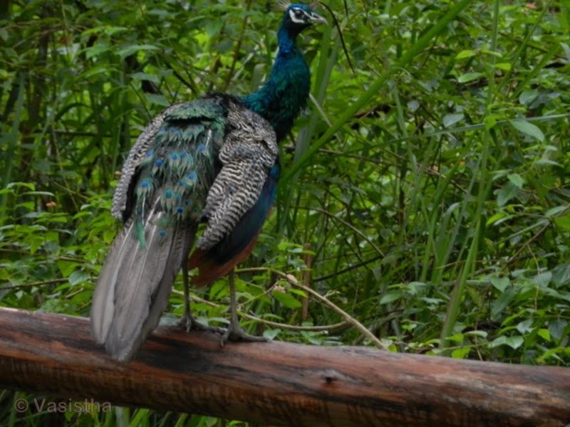
Wayanad Wildlife Sanctuary is an animal sanctuary in Wayanad, Kerala, south India. It is on the way from Mysore to Sultan Battery. Wild animals such as Indian Bison, elephant, deer and tiger has been spotted. There are also quite a few wild birds in the sanctuary.Peacocks and Peafowl tend to be very common in the area.

Wayanad Wildlife Sanctuary is the second largest wildlife sanctuary in Kerala. It is bestowed with lush green forests and rich wildlife. Also known as the Muthanga Wildlife Sanctuary, this wildlife area houses some of the rare and endangered species of both flora and fauna.

Established in 1973, the sanctuary is now an integral part of the Nilgiri Biosphere Reserve. It’s bounded by protected area network of Nagarhole and Bandipur of Karnataka in the northeast, and on the southeast by Mudumalai of Tamil Nadu.

It is part of the Wayanad plateau and the vegetation is predominantly of the south Indian moist deciduous teak forests. Also, the sanctuary has pastures of the west-coast semi-evergreen trees. The wildlife sanctuary comes under Protect Elephant and one can spot herd of elephants roaming in the area.

Elephant rides are arranged by the Forest Department,Kerala. Discovering and observing the wildlife while being atop an elephant is an enthralling and unforgettable experience. Wayanad district has the largest population of aborigine people in Kerala. The native aadivasis mainly consist of various sects like Paniyas, Kuruma s, Adiyar s, Kurichya s, Oorali s, Kattunaikkan s etc. Comprising an area of 2126 km2, Wayanad has a powerful history. Relicts and edicts found in various parts of Wayanad speak of an importatnt prehistoric era. Historians are of the view that organised human life existed in these parts, at least ten centuries before Christ.


The sanctuary is part of the Nilgiri Biosphere Reserve. The Western Ghats, Nilgiri Sub-Cluster (6,000+ km²), including all of the sanctuary, is under consideration by the UNESCO World Heritage Committee for selection as a World Heritage Site.[1]

Wayanad climate is salubrious. Average rain fall in this district is 2322 m.m. Annual rain fall in these high rain fall areas ranges from 3,000 to 4,000m.m. High velocity winds are common during the south west monsoon and dry winds blow in March-April. High altitude regions experience severe cold. This place experiences a high relative humidity which goes even up to 95 per cent during the south west monsoon period. Generally, the year is classified into four seasons, namely, cold weather, hot weather, south west monsoon and north east monsoon. The dale, 'Lakkidi', nestled among the hills of Vythiri taluk has the highest average rainfall in Kerala.


Location: Wayanad Wildlife Sanctuary is located 16 km east of Sulthan Bathery in the state of Kerala.

Edakkal Cave


The name “Edakkal” literally means “a stone in between”, and this describes how the cave is formed by a heavy boulder straddling a fissure in the rock. Inside the cave is on two levels, the lower chamber measures about 18 feet long by 12 feet wide and 10 feet high and can be entered through an opening of 5 x 4 feet. A passage opposite the entrance leads upward to a small aperture in the roof through which one climbs up to the next storey whose interior is about 96 feet long, 22 feet wide, and 18 feet high. Light enters the cave through a big gap at the right-hand corner of the roof where the boulder does not touch the facing wall.
The petroglyphs inside the cave are of at least three distinct types. The oldest may date back to over 8,000 years. Evidences suggest that the Edakkal caves were inhabited several times at different points in history.
The caves were accidentally discovered by Fred Fawcett, a police official of the erstwhile Malabar state in 1890 who immediately recognised their anthropological and historical importance. He subsequently wrote an article about them, attracting the attention of scholars.
The caves contain drawings that range over periods from as early as 5000 BC to 1000 BC. Recently the youngest group of paintings was in the news for a possible connection to the Indus Valley Civilization. Historian M.R. Raghava Varier of the Kerala state archaeology department identified a sign “a man with jar cup” that is the most distinct motif of the Indus valley civilization. The finding made in 2009 September indicates that the Harappan civilization was active in the region. 

Interestingly, the “a man with jar cup” symbol from Edakkal seems to be more similar to the Indus motif than those already known from Tamil Nadu and Karnataka. Mr. Varier said “The discovery of the symbols is akin to that of the Harappan civilisation having predominantly Dravidian culture and testimony to the fact that cultural diffusion could take place. It is wrong to presume that the Indus culture disappeared into thin air.” The scholar of Indus and the Tamil Brahmi scripts, Mr. Iravatham Mahadevan said the findings were very significant called it a "major discovery".

Location: located at Ambukutty Mala 25 km from Kalpetta.

Kuttanad


Kuttanadu is a region in the district of Alappuzha, in the state of Kerala, India, well known for its picturesque vast paddy fields and its geographical peculiarities. It's the region with the lowest altitude in India, and one of the few places in the world where farming is carried out below sea level. It’s also one of the historically important places in the ancient history of South India.
The Kuttanad region is broadly classified into three divisions:
          Lower Kuttanad
          Upper Kuttanad
          North Kuttanad
The major occupation in Kuttanad is farming. Rice is the important agricultural product, giving Kuttanad the moniker of "The Rice Bowl of Kerala". Three crops are grown every year now instead of the traditional two per year. Large farming areas near vembanad Lake were actually reclaimed from the lake. The history of the paddy cultivation in Kuttanad can be traced back to centuries. 
The evolution of paddy cultivation in Kuttanad was correlated to the technological advancement and changes in the regulatory frame work existed during the 19th and 20th centuries. In the earlier times, the reclamation was done mainly from the shallow part of the Vembanad Lake or from the periphery of river Pamba. These reclamations constituted small areas of paddy fields called “Padsekharams”.The bailing out of water from those fields were done manually using water wheels named “Chakram”. Gradually the manual method used for bailing out of water gave way to steam engines.
 
Location: Around 15 km from Alappy.


Wednesday, 15 June 2011

Kallayi River

          Kallayi is a small village on the banks of Kallayi River which links with the Chaliyar River on the south by a man-made canain. It is in the Kozhikode district of Kerala in south India. This village is famous for timber trading. Kallayi River is one of the rivers in Kerala, India. It originates in Cherikkulathur in the Western Ghats at an altitude of 45 m and is 40 km long. It is linked to the Chaliyar River by a man-made canal on the south side of the small timber village of Kallayi lying on its banks.
During late 19th century and early 20th century, the Chaliyar River was extensively used as a waterway for carrying timber from the forest areas in and around Nilambur to the various mills in Kallayi near Calicut. Rafts made of logs were taken downstream during the monsoon season to Kallayi, where these were sawn to size in the timber mills dotting the banks of the river.
During this period, Kallayi was one of the most important centers in the world for timber business. The place was famous for wood of superlative strength and durability like teak, rosewood etc. Towards the second half of the 20th century, the activity came down drastically as tree felling was banned or strictly controlled with a view to stop deforestation. Many mills still operate in Kallayi, though with far less output. Many have closed down.
 

Location: Just 2km from Calicut.
Related Posts Plugin for WordPress, Blogger...